AIS was developed to prevent ship collisions and enhance navigation safety. It works using transceivers on ships and extends to satellite systems to provide a comprehensive view of navigation. Ships equipped with AIS transmit vital information, which is received and displayed on monitoring systems. This data aids in traffic management, search and rescue operations, and environmental monitoring.
Unconventional Uses of AIS
Aircraft can transmit data such as their position, altitude, and speed. This information, collected and monitored by ground stations, augments existing air traffic control systems. The result is a more dynamic and precise method for managing air traffic, potentially reducing the risk of mid-air collisions and ensuring smoother aviation operations.
Researchers can study the environmental impact of these operations by tracking the movements of vessels involved in activities like fishing, oil drilling, and dredging. This data helps in assessing how human activities correlate with marine life patterns, pollution levels, and even broader climate change impacts. AIS aids in enforcing environmental regulations by providing evidence of illegal or harmful activities.
Illegal, unreported, and unregulated (IUU) fishing is a significant issue that endangers marine biodiversity. AIS technology helps combat this threat by enabling authorities to track and monitor fishing vessels’ movements. Patterns that suggest illegal fishing activities can be identified, allowing for timely intervention. Conservationists also use this data to create strategies that protect marine ecosystems and ensure sustainable fishing practices.
AIS technology is vital in coordinating relief efforts and ensuring the safe movement of rescue vessels in disaster-hit coastal areas. In scenarios like hurricanes or tsunamis, AIS helps streamline the delivery of aid, prevent vessel collisions, and manage marine traffic efficiently, thereby enhancing the overall disaster response.
It enables monitoring of ship arrivals, departures, and movements within harbors. This information assists port authorities in planning dock allocations, managing harbor space, and reducing vessel waiting times. Enhanced visibility of port activities leads to smoother operations and improved utilization of resources.
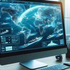
Security and Surveillance
AIS can monitor suspicious activities on the water. Authorities can track vessels, receive real-time updates on their positions, and observe patterns that may indicate illegal or potentially harmful behavior. This includes identifying ships that make unexpected detours, engage in unusual speed changes, or switch off their AIS transceivers to avoid detection. Analyzing these patterns, authorities can intervene promptly, preventing unlawful activities before they escalate.
It enables border protection agencies to monitor and control vessel movement near boundaries efficiently. This data ensures that authorities are alerted to any unauthorized entries, allowing for a quick response. This technology aids in combating smuggling, piracy, illegal immigration, and other issues that compromise national security.
 AIS helps in tracking vessels suspected of carrying contraband or engaging in illegal trade activities. Enforcement agencies can identify and intercept ships involved in these practices, thereby reducing the incidence of smuggling and ensuring compliance with international trade laws.
The effectiveness of AIS in maritime security is amplified when integrated with other security systems. Combining AIS data with radar, satellite imagery, and other surveillance technologies provides a comprehensive view of maritime activities. This integrated approach allows for more accurate vessel identification, improved tracking, and enhanced situational awareness. Advanced analytics and machine learning can be applied to the collected data, offering predictive insights and early warnings of potential threats.
AIS technology helps in deterring and managing piracy incidents by providing information on vessel movements in piracy-prone waters. Ships can report their positions continuously, allowing naval forces and coast guards to monitor and protect these vessels more effectively. Historical AIS data helps in analyzing piracy patterns and developing strategies to combat these threats more efficiently.
Critical maritime infrastructure, such as offshore oil rigs, underwater pipelines, and ports, requires constant protection from potential threats. AIS systems aid in monitoring the areas surrounding these infrastructures, ensuring that any unauthorized vessels are detected and tracked promptly. This is important for safeguarding important assets against sabotage, terrorism, and accidental damage.
AIS technology provides data that is necessary for coordinating incident response efforts. Rescue teams, law enforcement, and other relevant authorities can quickly assess the situation, organize their response, and track involved vessels. This is invaluable for minimizing damage, ensuring public safety, and maintaining order.
The Agricultural Sector
The fishing industry faces significant challenges, including overfishing, illegal fishing, and resource depletion. AIS technology addresses these challenges by providing precise data on vessel movements. This data helps regulatory bodies monitor fishing activities and enforce compliance with established fishing quotas and maritime laws. Authorities can ensure sustainable fishing practices, preserving marine resources for future generations.
AIS technology aids aquaculture farms, farming fish, crustaceans, mollusks, and aquatic plants, by monitoring vessels that operate within or near their farms. This monitoring ensures the security of their operations and helps in planning the logistics of feeding, harvesting, and transporting aquatic products. Farm operators can optimize farm layouts and improve the overall efficiency of their operations.
This technology supports sustainable practices by providing comprehensive data that enhances decision-making. Fshery managers can analyze AIS data to understand migration patterns and spawning habits of various fish species. This understanding helps in setting appropriate fishing seasons and protecting important habitats, thereby reducing the environmental impact of fishing activities.
AIS facilitates the optimal use of resources by providing detailed information on vessel locations and activities. Farm managers can plan feeding schedules, maintenance, and harvests based on the precise movements of their vessels. This leads to efficient use of time, labor, and materials, ultimately improving productivity and profitability.
Researchers can analyze vessel movement patterns to study their impact on marine ecosystems. This data helps in understanding the interactions between agricultural activities and marine biodiversity. Insights gained from AIS data empower researchers to develop strategies and policies that balance agricultural productivity with environmental conservation.
By analyzing ship movements and related weather conditions, meteorologists can generate more accurate weather models and understand climate impacts on different areas. AIS assists in collecting real-time data on sea states, wind patterns, and ocean temperatures, contributing to better predictive models for weather and climate change.
Leveraging AIS in Smart Cities
AIS can provide data for managing urban waterfronts and coastal areas, integrating with transport systems, and even contributing to urban planning and developmental projects. In cities with significant water transport services, AIS helps manage passenger ferries and goods transportation, reducing congestion and improving public safety.
Artificial intelligence algorithms can analyze AIS data sets to predict vessel movements, optimize routes, and detect anomalies that indicate potential hazards or illegal activity. AI-powered analytics help make proactive decisions, improving safety and efficiency in a variety of areas.
With a comprehensive understanding of vessel movements and activities, authorities can ensure compliance with international regulations, such as those set by the International Maritime Organization (IMO), and develop policies that address evolving threats and challenges in the maritime sector.