As marine traffic continues to increase, the risk of these majestic animals suffering from vessel strikes has become a grave concern. Ship collisions can result in serious injury or death for marine life and can negatively impact biodiversity.
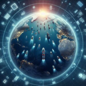
Beyond Ship-to-Ship
Initially designed to enhance maritime safety by avoiding vessel collisions, the potential of AIS to protect marine life is now being seriously considered. The use of AIS can be extended to monitor large marine animals, transmitting their locations to nearby vessels, and providing real-time updates to seafarers. Through this, mariners are equipped with the necessary information to navigate responsibly in areas populated with marine life.
Data from AIS can be used to track the movement patterns of ships with key habitats and migration routes of marine animals. This facilitates the identification of areas where marine traffic overlaps significantly with marine life presence, allowing for informed decision-making and preventive action.
The expansion of AIS relies on robust collaboration with marine biologists, conservationists, and technology experts. Together, they can create and refine protocols for tagging marine animals in a manner that is both efficient and non-intrusive. Tech experts need to ensure the AIS transmitters are specifically designed for marine fauna and that they deliver precise data.
For AIS signals from marine animals to be effectively recognized and to prompt the desired change in vessel operations, the system must be flawless. Ship captains and crew members require clear, reliable, and distinguishable AIS data to make informed decisions. To tackle this, AIS transmitters on marine animals could transmit unique identification signals that shipboard AIS receivers can interpret correctly as coming from wildlife and not from other vessels.
Ship operators and voyagers need to be willing partners in decision-making processes. They must be receptive to the data received from tagged marine animals and take the necessary actions recommended by the AIS system. This includes changing course or slowing down, even if it might momentarily affect scheduling. The maritime community’s commitment to the extended use of AIS determines the success of its role in environmental protection.
Vessel Speed Reduction
When vessels navigate at lower speeds, they provide two main benefits in terms of environmental protection: less noise pollution and reduced collision risk. Quieter waters enable marine species to communicate more effectively, important for their survival and breeding. Slower speeds afford animals a greater chance to detect and avoid approaching vessels, thereby decreasing the likelihood of deadly interactions.
 Various international and national legal frameworks have been put in place to enforce speed limits in designated areas. These measures are particularly focused on regions known to be habitats for endangered marine species. Compliance with these regulations is necessary, and AIS can play an integral role in ensuring adherence. By continuously monitoring vessel speeds, AIS can alert ship operators when they are exceeding speed restrictions, prompting them to reduce their velocity accordingly.
To encourage shipping companies to partake in speed reduction initiatives, incentive programs have been created. These can take the form of reduced port fees or recognition for companies that commit to operating at lower speeds in sensitive areas. These initiatives acknowledge the impact that commercial operations have on the marine environment and seek to reward those prioritizing sustainability.
The system’s capacity to send and receive real-time information about vessel movements and velocities makes it an effective tool for monitoring adherence to speed limits. Upon identifying an area with high marine animal presence using AIS data, operators can take immediate action to adjust their speed.
Engagement with Marine Spatial Planning
Engagement with MSP involves plotting out areas used for various purposes such as shipping lanes, fishing areas, conservation zones, and more. MSP allows for a more significant understanding of how spaces are utilized and what measures might be necessary to mitigate the impact on the environment.
It provides precise information about the movement of vessels, which is invaluable for creating efficient and effective spatial plans. Routes frequented by large vessels can be analyzed and potentially adjusted to minimize overlaps with environmental conservation areas or animal migration paths, thereby reducing human-induced risks to marine life.
Developing effective Marine Spatial Plans requires collaboration among various stakeholders, including government agencies, environmental groups, and the maritime sector. AIS data is particularly beneficial in these collaborative efforts as it offers definitive evidence around vessel movements, which is necessary for informed decision-making and policy development.
As conditions change and new information, such as AIS data, becomes available, plans may need to be re-evaluated and modified. Engagement with MSP allows maritime planners to be responsive to the dynamic nature of marine ecosystems and human use patterns, ensuring that the plans remain relevant and effective.
Integrating with Other Technologies
AIS serves as a powerful core technology, providing an array of vessel data to users worldwide. Its full potential is unlocked when combined with other maritime technologies. Integrating AIS with radar systems can give a clearer picture of a vessel’s immediate surroundings, including those that may not be AIS-equipped.
Satellite technologies offer a vantage point for monitoring maritime traffic that is not bound by the limitations of terrestrial systems. By uniting satellite data with AIS information, we gain a global perspective, tracking vessels across open oceans where land-based systems have no reach.
Geographic Information Systems (GIS) are vital for visualizing AIS data spatially, layering this information over detailed maps that include bathymetric features, marine protected areas, and other critical habitats. The integration of AIS into GIS applications allows for better planning and decision-making regarding vessel routing and maritime operations.
Data analytics are necessary in making sense of the vast amount of information collected by AIS and other sources. Sophisticated data analytics can identify patterns of maritime traffic, predict areas of high risk for collisions with marine life, and suggest optimal routes to minimize environmental impact.
Passive Acoustic Monitoring (PAM) systems detect marine mammal calls, which can be used in conjunction with AIS to pinpoint locations where there is a high likelihood of encountering marine life. Knowledge derived from the use of PAM can inform ship operators to proceed with caution or to alter their course to avoid disturbing sensitive species.
As vessels integrate and utilize multiple technologies in concert with AIS, they strengthen their ability to adhere to international regulations that govern maritime safety and environmental standards. Technologies that verify and document compliance help maintain accountability within the maritime community.
With increased connectivity comes the need for robust cybersecurity measures. Protecting the data integrity and preventing unauthorized access to maritime systems is necessary, especially as the information gathered can have significant safety and environmental implications.