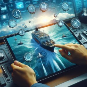
The Automatic Identification System is a tracking system used on ships and by vessel traffic services for identifying and locating vessels by electronically exchanging data with other nearby ships and AIS base stations. Information such as vessel identity, type, position, course, and speed are broadcasted at regular intervals, offering a comprehensive view of maritime traffic within an area.
When AIS data is combined with radar outputs and electronic charts, the bridge crew gains a detailed and accurate picture of the maritime traffic, weather patterns, and potential hazards. This tapestry of information arms the crew with the knowledge necessary to make timely and informed decisions, particularly in dense traffic zones or during adverse weather conditions.
The marine traffic-monitoring capabilities of AIS when amalgamated with radar and chart plotting systems enable the crew to anticipate and react to potential collision scenarios with greater precision. Systems communication ensures that the vessel actively monitors and responds to the movement of nearby vessels.
Integration also simplifies information management aboard a modern ship. In the past, sailors and officers had to manually interpret and analyze data from separate instruments. Today, through integration, data from various sources can be aggregated in a streamlined manner, reducing the potential for human error and enhancing overall safety.
With systems sharing and processing data automatically, seafarers can dedicate more attention to critical decision-making and vessel operation strategies. It relieves the pressure on the crew, who otherwise would have to manage each system in isolation and attempt to mentally coalesce the information.
Harmonizing AIS with other navigational tools aboard a vessel supports decision support systems. Recommendations for route adjustments based on the confluence of data from current, wind and maritime traffic conditions can make significant differences in fuel consumption, time-saving, and ensuring a punctual and safe journey.
Integration Techniques
Professionals must evaluate the existing systems to ensure that they are compatible for integration. This involves reviewing technical specifications, such as communication protocols, to ascertain whether the systems can share data effectively.
Setting clear objectives, such as what data must be shared and what the outcome of combining systems should be, is necessary at this stage to guide the integration process.
Interfaces like NMEA 0183 and NMEA 2000 allow for the standardization of data communication between electronics. Configuration involves setting the interfaces to enable effective data transfer rates, which is important for real-time navigation.
Physical Installation involves the hands-on work of connecting the systems using data cables and ensuring that the physical connection points are secure. Professional installation is necessary to prevent data loss and maintain the integrity of the navigational systems.
With the physical connections in place, software must be configured to ensure the integrated systems communicate properly. Settings within one system, such as ECDIS, can be adjusted to recognize and correctly display data from AIS and vice versa.
The systems are calibrated to ensure the accuracy of displayed information. This might include aligning sensor data or adjusting data output intervals. Calibration ensures that all systems interpret and present data in a uniform and accurate manner.
After calibration, thorough testing under a range of conditions is critical to detect any issues. This verification process includes simulating different navigational scenarios to ensure the integrated systems perform as expected.
The ship’s crew must be educated and trained in the use of the newly integrated systems. Competence in interpreting the combined data and utilizing the full capabilities of the integrated system is key to realizing its benefits.
Practical Scenarios for AIS Integration
By feeding AIS data into radar and ECDIS, the systems can provide real-time visuals of nearby vessel traffic. Officers can monitor the course and speed of other ships, enabling them to make strategic maneuvers well in advance to prevent collision risks. This coordination is a significant step forward from relying on radar alone.
 Before departure, AIS integration supports more efficient route planning by delivering critical information on maritime traffic patterns, especially in high-traffic areas. This allows for the adjustment of routes to avoid congestion, minimize journey time, and save fuel. Real-time AIS data may inform changes to the plan during a voyage, adding a dynamic edge to navigation.
Upon approaching or leaving port, vessels need to ensure timely and accurate communication with port authorities and other vessels. With AIS integration, a ship’s current status and intentions are visible, facilitating smoother and faster port operations, leading to reduced waiting times in anchorage areas and better scheduling.
Integrating AIS with other navigational systems enables quick acquisition and sharing of data. Identifying and tracking vessels in distress becomes more straightforward and coordinated, potentially resulting in faster and more targeted rescue efforts.
For fleet managers and maritime authorities, integrated systems can provide comprehensive vessel tracking and management capabilities, ultimately leading to improved oversight and increased compliance with maritime regulations.
With AIS data integrated into systems like chart plotters and radar, the potential for human navigational errors is significantly reduced. High-risk maneuvers, like navigating narrow straits and channels, are made safer as AIS provides additional data to corroborate radar readings and chart references.
By allowing for the optimization of sea routes, AIS integration contributes to the reduction of emissions by helping ships travel shorter distances and utilize less fuel. In areas sensitive to environmental impact, AIS data can help avoid navigational routes that may cause ecological harm.
During conditions of poor visibility, such as fog or storms, the visual capacity of radar can be complemented with the AIS data to ensure that the electronic picture remains accurate. This heightened awareness assists seafarers in navigating safely when visual cues are limited.