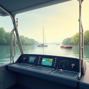
Commercial vessels equipped with AIS transceivers automatically transmit data such as position, speed, course, and other essential navigational information. These transceivers broadcast their messages over VHF radio frequencies, which can then be picked up by other vessels, shore stations, and navigation centers within range.
AIS provides real-time data that’s easy to understand and interpret. This live data feed offers an overview of boat traffic, making it invaluable for avoiding collisions, understanding busy traffic areas, and managing navigational routes — especially in the often confined spaces of inland waterways.
Navigating the Narrow and Busy Waters
Inland waterways may be smaller than the open ocean, but they’re no less busy. Rivers and lakes see everything from massive cargo barges to leisure craft, all moving in different directions and at varied speeds. This mixed traffic presents unique navigation challenges that AIS can help mitigate.
With AIS, the captain of a cargo barge can “see” vessels beyond the immediate line of sight. For instance, boats around the next bend or tucked into a busy port. This allows for anticipatory maneuvers rather than reactive ones, meaning you’re adjusting course with more information to avoid potential issues before they become problems.
The data provided by AIS helps operators make informed navigational decisions, avoids bottlenecks that could lead to collisions or delays, and ensures that everyone is on the same page about traffic conditions. By enhancing situational awareness, AIS contributes to smoother sailing even in the most chaotic spots.
Enhanced Collision Avoidance
Collision avoidance in inland waters used to rely heavily on manual observation and sound signals. While sailors still need to keep a sharp lookout, AIS adds another layer of safety that wasn’t possible before.
The system’s ability to provide vessel information in real time means that ships can adjust their paths well in advance of potential collisions. There’s plenty of time to coordinate a safe passing, using less guesswork and nerves than a last-minute emergency maneuver might entail.
This technology works just as well at night or in poor visibility conditions like fog or heavy rain. While radar can help in these situations, AIS adds a layer of data that tells you exactly what’s nearby and how it moves.
Leveraging AIS for Docking Procedures
Docking is one of the most challenging tasks when navigating inland waterways. Tight spots, varied traffic, and complex port layouts can test even experienced captains. AIS offers valuable insights that make docking less stressful and more predictable.
Take the example of approaching a busy port. With AIS, a person gets a clearer picture of which berths are occupied or soon to be available. It can communicate effectively with port authorities and other vessels, ensuring a coordinated approach to docking. This means it spends less time maneuvering and more time focused on safety procedures.
The efficiency boost that AIS provides during docking extends to tug operations as well. Tug operators can plan their tasks effectively by tracking incoming vessels and arranging assistance as needed, ensuring everything stays on schedule and runs smoothly.
 Integrating AIS with Modern Navigation Systems
AIS works best when integrated with modern navigation systems like ECDIS (Electronic Chart Display and Information Systems). Combining these technologies paints a detailed picture of the waterway, complete with detailed charts, real-time vessel movements, and obstacles or navigational challenges.
If steering a ship through an unfamiliar lake where charts alone wouldn’t reveal everything you need to know, with ECDIS and AIS working in tandem, you get full situational awareness. The electronic chart updates in real time as you move, reflecting the accurate positions of other vessels. This prevents accidents and assists in route planning, reducing time and fuel consumption.
AIS data can be fed into ARPA (Automatic Radar Plotting Aids) systems, providing additional targeting information for radar plots. This capability allows the crew to better understand which targets are true concerns for safety and navigation, as opposed to inconsequential contacts like harmless buoys or structures.
Monitoring Environmental Impact
Inland waterways often pass through ecologically sensitive areas where environmental conservation is crucial.
AIS data contributes to better management of vessel traffic, reducing excessive wake or vibration that can harm local wildlife and erode banks. By analyzing AIS data, authorities can impose speed limits or restrict traffic during certain times, safeguarding the waterway’s health.
Data from AIS also helps track shipping patterns over time, providing insights to adjust shipping routes for minimal environmental disruption.
Improving Rescue Operations and Incident Management
Emergencies happen wherever vessels navigate. AIS is an invaluable tool in emergency response and incident management on inland waterways, enhancing both safety and efficiency.
When distress signals are sent via AIS, they immediately broadcast the vessel’s exact location, nature of distress, and other critical details to nearby vessels and response teams. This rapid transmission speeds up rescue efforts, guiding emergency teams accurately to the site without losing precious time.
In case of accidents, AIS records can be reviewed to understand the sequence of events leading to the incident, providing insights for future safety measures. Ships can track and offer immediate help to nearby vessels experiencing problems, significantly cutting down on response times.
Expanding Connectivity and Infrastructure
AIS effectiveness improves as more vessels and stations come onboard. Expanding AIS infrastructure along inland waterways promises enhanced coverage and reliability, improving safety and navigation for all vessels.
Shore-based stations placed strategically along rivers, lakes, and canals expand the reach of AIS data, allowing these systems to feed into broader traffic management strategies. Authorities can analyze traffic patterns and adopt smarter waterway management policies.
Investment in technology such as satellites and terrestrial networks ensures that even the remote stretches of inland waterways have coverage. This connectivity is crucial not just for navigation but also for emergency preparedness and response. Continuous expansion means faster, more reliable information-sharing across the board.